DTU running path dataset
(→Source code) |
(→Source code) |
||
| (4 intermediate revisions by one user not shown) | |||
| Line 2: | Line 2: | ||
== Vision Assisted Path Navigation for Autonomous Robot == | == Vision Assisted Path Navigation for Autonomous Robot == | ||
| − | Frederik Emil Thorsson Schöller | + | Frederik Emil Thorsson Schöller and Martin Krarup Plenge-Feidenhans’l |
| − | Martin Krarup Plenge-Feidenhans’l | + | Master of Science in Engineering 2019 |
| − | Master of Science in Engineering | + | |
| − | 2019 | + | |
Full thesis: https://findit.dtu.dk/en/catalog/2444130462 | Full thesis: https://findit.dtu.dk/en/catalog/2444130462 | ||
| + | |||
| + | or | ||
| + | |||
| + | http://aut.elektro.dtu.dk/staff/jca/dtu_running_path_dataset/Vision_assisted_path_navigation_for_autonomous_robot.pdf | ||
=== Abstract === | === Abstract === | ||
| Line 27: | Line 29: | ||
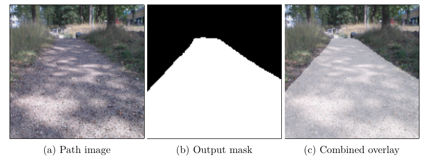
[[File:path_segmentation_result.png]] | [[File:path_segmentation_result.png]] | ||
| + | |||
| + | Figure 1. Example from the segmentation. | ||
=== Images and annotations === | === Images and annotations === | ||
| Line 36: | Line 40: | ||
=== Source code === | === Source code === | ||
| − | Python scripts used | + | Python scripts etc used in the project |
| − | http://aut.elektro.dtu.dk/staff/jca/ | + | http://aut.elektro.dtu.dk/staff/jca/dtu_running_path_dataset/path_navigation_source.zip |
Latest revision as of 16:46, 28 March 2019
Contents |
[edit]
Frederik Emil Thorsson Schöller and Martin Krarup Plenge-Feidenhans’l Master of Science in Engineering 2019
Full thesis: https://findit.dtu.dk/en/catalog/2444130462
or
[edit] Abstract
The main focus of this project is to propose a solution enabling a robot to robustly navigate a chosen forest path utilizing computer vision. The robot should be able to navigate the entire path, excluding public roads. While autonomously navigating the path, the solution should enable the robot to avoid obstacles such as pedestrians while also providing means to stop the robot when approaching public roads. A deep learning approach is used, providing the solution with a semantic segmenta- tion of the acquired images, splitting these into path and background. The segmented images are processed using classical image analysis in order to provide the robot with a driving direction, making it follow the path. A GPS based point of interest system has also been added, enabling the robot to stop when approaching traffic, while also providing a way of e.g changing parameters when driving a particularly difficult path segment. Through testing, the developed system has been successfully evaluated and the sug- gested solution was found to fulfill the project goals.
Figure 1. Example from the segmentation.
[edit] Images and annotations
The images and annotations (8679 images) - in total 2.6 GB
http://aut.elektro.dtu.dk/staff/jca/dtu_running_path_dataset/running_path_data_set.tar.gz
[edit] Source code
Python scripts etc used in the project
http://aut.elektro.dtu.dk/staff/jca/dtu_running_path_dataset/path_navigation_source.zip
